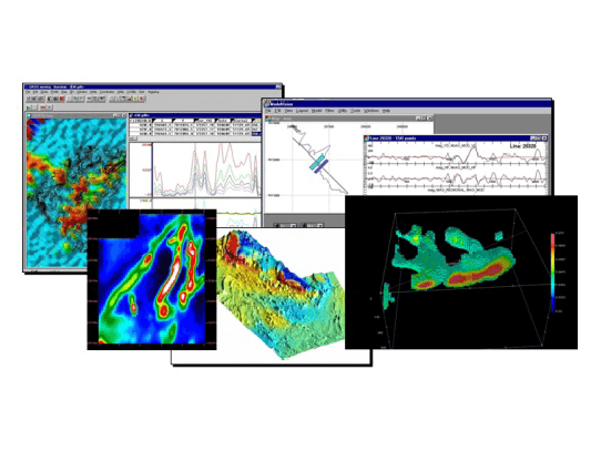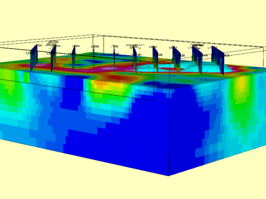
Modelling, particularly in the 3D space, is becoming the industry standard for many types of geophysical data. GD’s team of geophysicists can invert entire regions or target scale areas, and then integrate this information in 3D visualization packages with any existing data (such as drill hole traces, assay information, downhole geophysical logs). This approach provides a distinct advantage to the traditional method of interpreting 2D grids – in the 3D space, the geometry of targets can be discerned, the depth to targets can be obtained and drill holes better defined to intersect the target of interest.
At GD, we run specialist 3D inversion software on powerful, high performance PCs, so that you can get the most out of your geophysical datasets. 2D profile modelling of data can also be carried out and is certainly advantageous in some environments.