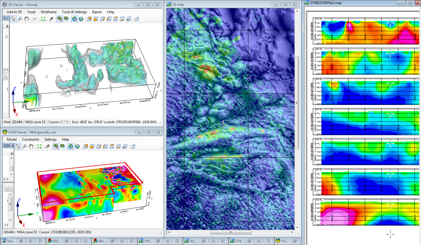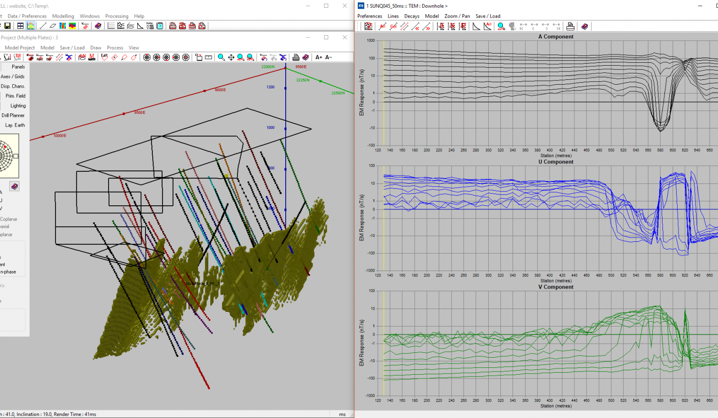
A large part of our business comes from clients seeking a detailed and comprehensive compilation of open file company and government geophysical data. At GD, we have direct access to these vast datasets (ground gravity databases, airborne gravity surveys, magnetic data, radiometric data and Magnetotellurics), and can extract then process the information quickly and cost effectively. The end result is often a series of high resolution images in GIS format, ready to incorporate into the clients own data interpretation package. GD can also compile any other relevant geological and cadastral information available from a variety of sources.
Once all relevant information has been obtained and processed (and where applicable, modelled), detailed geological and structural interpretations can then be carried out and targets selected. A key advantage of using GD is our ability to integrate these specialist geophysical services in team-based target generation and assessment.